Bryce Canyon National Park Terrain360 Map Collection

Hoodoos and Forest Mixed Together

Hoodoos (odd-shaped pillars of rock) can be found on every continent, but here is the largest collection of hoodoos in the world!

Bryce Canyon National Park is a National Park located in southwestern Utah in the United States. The major feature of the park is Bryce Canyon, which despite its name, is not a canyon, but a collection of giant natural amphitheaters along the eastern side of the Paunsaugunt Plateau. Bryce is distinctive due to geological structures called hoodoos, formed by frost weathering and stream erosion of the river and lake bed sedimentary rocks. The red, orange, and white colors of the rocks provide spectacular views for park visitors. Bryce sits at a much higher elevation than nearby Zion National Park. The rim at Bryce varies from 8,000 to 9,000 feet (2,400 to 2,700 m).

Most park visitors sightsee using the scenic drive, which provides access to 13 viewpoints over the amphitheaters. Bryce Canyon has eight marked and maintained hiking trails that can be hiked in less than a day (round trip time, trailhead). Several of these trails intersect, allowing hikers to combine routes for more challenging hikes. The park also has two trails designated for overnight hiking: the 9-mile (14 km) Riggs Spring Loop Trail and the 23-mile (37 km) Under-the-Rim Trail. In total there are 50 miles (80 km) of trails in the park.

The park has a 7.4 magnitude night sky, making it one of the darkest in North America. Stargazers can, therefore, see 7,500 stars with the naked eye, while in most places fewer than 2,000 can be seen due to light pollution, and in many large cities only a few dozen can be seen. The air in the area is so clear that on most days from Yovimpa and Rainbow points, Navajo Mountain and the Kaibab Plateau can be seen 90 miles (140 km) away in Arizona.


Hat Shop Trail (2.18 mi)

37.604366, -112.15686
Hat Shop Trail  scene image looking forward

Inspiration Point (0.05 mi)

37.61327, -112.169632
Inspiration Point scene image looking forward

Navajo Loop Trail (1.48 mi)

37.625448, -112.161138
Navajo Loop Trail scene image looking forward

Queen's Garden (0.8 mi)

37.628438, -112.162927
Queen's Garden  scene image looking forward

Rim Trail (5.75 mi)

37.649187, -112.147381
Rim Trail  scene image looking forward

Sunrise Point (0.11 mi)

37.629523, -112.163076
Sunrise Point scene image looking forward

Sunset Point (0.06 mi)

37.615795, -112.170303
Sunset Point  scene image looking forward

Tower Bridge Trail (0.13 mi)

37.633381, -112.146018
Tower Bridge Trail  scene image looking forward

Explore the Map

Click on any line in the map to explore the location in street view.

Enjoy the Fairyland Loop Trail

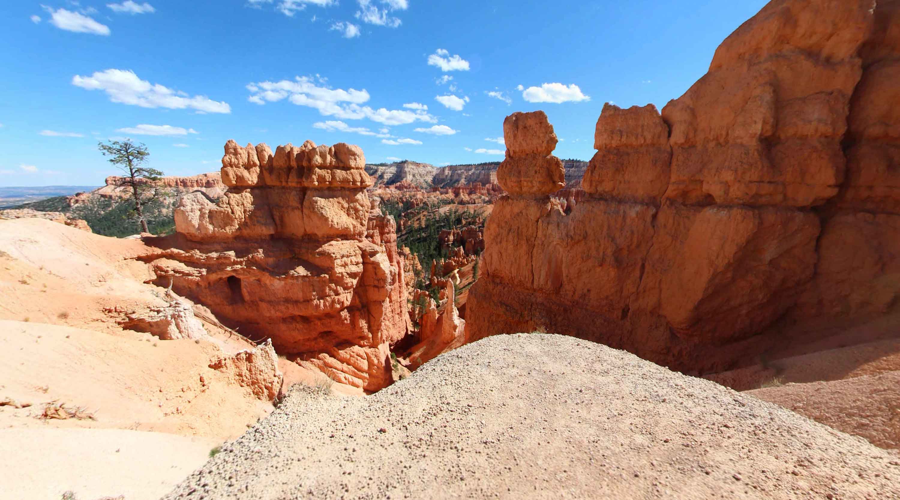
It begins at Fairyland Point, at the northern portion of the park, and takes you through spectacular hoodoos and scenery along the rim and into the canyon!