Sherando Lake Recreation Area Terrain360 Map Collection

The Jewel of the Blue Ridge Mountains

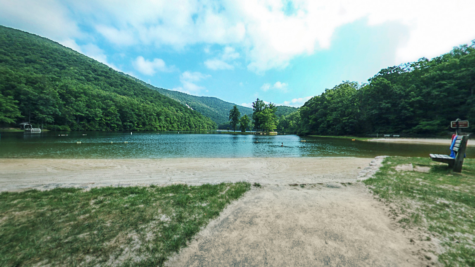
The Sherando Lake Recreation Area lies within the scenic Blue Ridge Mountains and is one of the most popular recreation areas in the George Washington National Forest. The area includes 2 lakes with most of the recreational facilities lying between them. Lower Sherando is the largest lake, encompassing 25 acres of cool, spring-fed waters. Upper Sherando Lake is the smaller lake at 7 acres, available for fishing only. The lower lake is available for swimming, fishing or relaxing on the sand beach.

Sherando Lake Recreation Area features swimming, camping, picnicking, hiking, and fishing. The campground has 65 family campsites as well as group sites. Access to multiple trailheads and rustic architecture provide numerous points of interest. The hiking opportunities include the Blue Loop Trail, the Lakeside Trail and the Torry Ridge Trail that heads to Bald Knob. 

Source: Virginia.org, Recreation.govFs.usda.gov

Blue Loop 2 (0.14 mi)

37.92511, -79.008675
Blue Loop 2  scene image looking forward

Blue Loop 3 (0.2 mi)

37.925682, -79.009468
Blue Loop 3  scene image looking forward

Cliff Trail (0.71 mi)

37.92065, -79.003845
Cliff Trail  scene image looking forward

Dam Trail (0.32 mi)

37.925564, -79.004112
Dam Trail  scene image looking forward

Lakeside Trail (0.99 mi)

37.921619, -79.003365
Lakeside Trail  scene image looking forward

Overlook Rock (0.02 mi)

37.925442, -79.00956
Overlook Rock  scene image looking forward

Slacks Trail (1.7 mi)

37.907562, -79.050026
Slacks Trail  scene image looking forward

SLRA Dock (0.02 mi)

37.921819, -79.0054
SLRA Dock scene image looking forward

SLRA Gift Shop (0.02 mi)

37.920223, -79.005074
SLRA Gift Shop  scene image looking forward

SLRA Island (0.06 mi)

37.92234, -79.004112
SLRA Island  scene image looking forward

SLRA Island Access (0.03 mi)

37.921646, -79.003532
SLRA Island Access  scene image looking forward

Torry Ridge Trail (1.01 mi)

37.926224, -79.012466
Torry Ridge Trail  scene image looking forward

White Rock Falls (1.39 mi)

37.896225, -79.046074
White Rock Falls  scene image looking forward

White Rock Falls 2 (0.39 mi)

37.901531, -79.055901
White Rock Falls 2  scene image looking forward

White Rock Falls 3 (0.42 mi)

37.902431, -79.055206
White Rock Falls 3  scene image looking forward

Explore the Map

Click on any line in the map to explore the location in street view.

Explore Sherando Lake Recreation Area

from the best point of view - the island